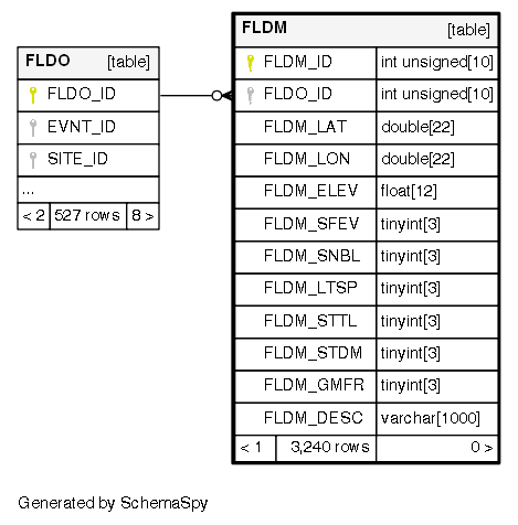
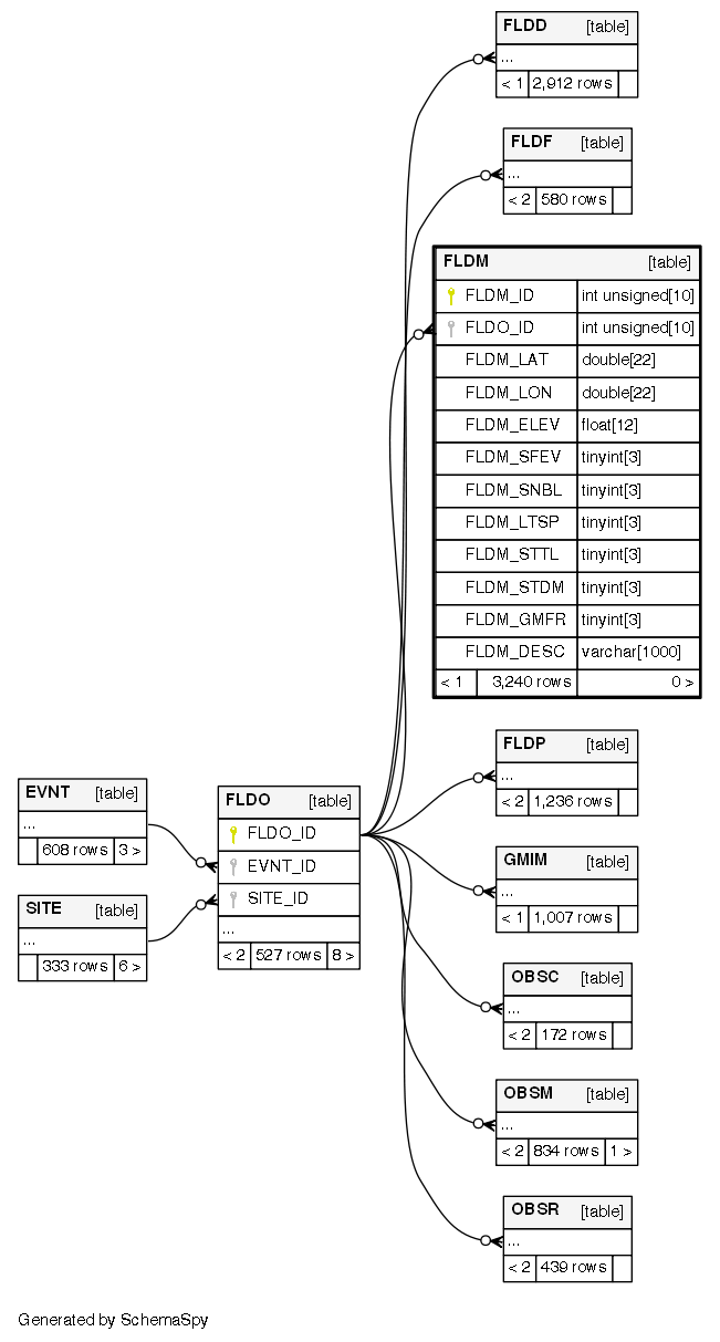
Columns
| Column | Type | Size | Nulls | Auto | Default | Children | Parents | Comments | ||
|---|---|---|---|---|---|---|---|---|---|---|
| FLDM_ID | INT UNSIGNED | 10 | √ | null |
|
|
Unique ID (primary key) for entries in the FLDM table |
|||
| FLDO_ID | INT UNSIGNED | 10 | √ | null |
|
|
||||
| FLDM_LAT | DOUBLE | 22 | √ | null |
|
|
Latitude of liquefaction manifestation in WGS84 (deg) |
|||
| FLDM_LON | DOUBLE | 22 | √ | null |
|
|
Longitude of liquefaction manifestation in WGS84 (deg) |
|||
| FLDM_ELEV | FLOAT | 12 | √ | null |
|
|
Elevation of liquefaction manifestation in m |
|||
| FLDM_SFEV | TINYINT | 3 | √ | null |
|
|
Indication of surface manifestation of liquefaction (1=Yes surface manifestation of liquefaction, 0=No surface manifestation of liquefaction - FLDM_SFEV=0 does not mean that liquefaction did not occur, it means that no surface manifestations (e.g. sand boils, gorund cracks) have been observed) |
|||
| FLDM_SNBL | TINYINT | 3 | √ | null |
|
|
Indication of sand boil (1=Yes, 0=No) |
|||
| FLDM_LTSP | TINYINT | 3 | √ | null |
|
|
Indication of lateral spread (1=Yes, 0=No) |
|||
| FLDM_STTL | TINYINT | 3 | √ | null |
|
|
Indication of settlement (1=Yes, 0=No) |
|||
| FLDM_STDM | TINYINT | 3 | √ | null |
|
|
Indication of structural damage (1=Yes, 0=No) |
|||
| FLDM_GMFR | TINYINT | 3 | √ | null |
|
|
Co-located recording station evidences (0=no co-located record, 1=No evidence of liquefaction in the record, 2=Yes evidences of liquefaction in the record, 3=Doubtful evidences) |
|||
| FLDM_DESC | VARCHAR | 1000 | √ | null |
|
|
Observation description (1=Yes, 0=No) |
Indexes
| Constraint Name | Type | Sort | Column(s) |
|---|---|---|---|
| PRIMARY | Primary key | Asc | FLDM_ID |
| FLDO_ID | Performance | Asc | FLDO_ID |

